Drilling Report . - Continuing Success with near-surface drilling at Parys Mountain
15 Novembre 2006 - 8:00AM
UK Regulatory
    Anglesey Mining plc

15 November 2006                                              LSE: AYM

Continuing success with near surface drilling at Parys Mountain

 *    Eight holes now completed on White Rock Zone
       Zone continuous between surface and 280 metre level
 *    Four holes completed on the Upper Engine Zone
       Mineralization continues for 150 metres above 280 metre level
 *    Early underground access and mining planned from these areas
 *    A new third zone of mineralization identified

Anglesey Mining plc is pleased to report that twelve holes have now been completed
in the 2006 drilling programme adjacent to the Morris Shaft at its Parys Mountain
project in North Wales, eight on the White Rock Zone and four on the Upper Engine
Zone.  The White Rock drilling confirms continuation of the White Rock Zone
through to surface, with one intersection of over 68 metres.  The drilling of the
Upper Engine Zone has demonstrated mineralization to 150 metres above the 280
metre level including base metal intersections of 11.3% and 16.1%.  A new third
zone of mineralization has been identified within the Penymynydd Fault Zone which
separates the White Rock and Engine Zones including a narrow intersection of over
40% base metal.

"These latest results and the subsequent interpretation of the geology of the
relevant zones confirm our confidence in the ability for Parys Mountain Mine to
become a significant producer in a short time frame.  This recent drilling on
White Rock and the Upper Engine Zone represents a change of emphasis from prior
drilling which demonstrated the long term potential of the property" said Bill
Hooley, Executive Director of Anglesey Mining.  "With these latest results to
hand, we are now able to move into the next phase of the project which will
involve detailed mine access and stope planning ahead of the commencement of
underground mining from these relatively shallow zones."

Assay results have now been returned for nine holes.  Two holes (WD6 & CZ12) were
located on the fringes of the ore-bodies and were not sent for assay.  Assay
results are still awaited from one hole (CZ13).  Drilling currently continues on
one further hole (WD9) in the White Rock Zone.

The principal assay results obtained from holes not previously reported are as
follows:

              Width    Cu       Pb      Zn       Ag       Au
               (m)     (%)      (%)     (%)     (ppm)    (ppm)
                        White Rock Zone
WD5            2.7    0.88     3.22    7.56      50      0.10

WD7           68.4    0.18     1.35    2.49      22      0.50
  including   44.6    0.22     1.78    3.18      24      0.52
   including  11.3    0.27     2.58    4.98      40      1.24
plus           7.1    0.34     1.71    2.99      20      0.11

WD8           22.4    0.53     3.97    7.07      101     1.95
  including   14.8    0.73     5.59    9.92      127     2.52

             Engine Zone and Penymynydd Fault Zone

CZ10           0.6    4.23     13.28   22.61     84      0.38
plus           3.0    1.24     3.91    6.13      54      1.87
plus           1.7    0.74     1.56     3.9      11      0.03

CZ11           3.7    0.44     2.39    4.18      59      0.44
plus           2.7    1.43     5.27    9.36      50      1.24

White Rock

The White Rock Zone was originally identified during the underground development
programme in 1990.  A large part of the zone was located near the 280 metre level
driven from the Morris Shaft and the current drilling programme was designed to
explore the upward continuity of this zone towards the surface which had only
been partially identified from earlier drilling.  The indicated resource estimate
on the White Rock Zone calculated in 1990 was:

840,000 tonnes at 0.49% Cu, 3.44% Pb, 6.84% Zn, 42ppm Ag, and 0.45ppm Au.

The current round of drilling has confirmed that two separate and parallel lens
systems exist in the White Rock Zone.  These have been designated the Main Lens
and the Upper Lens.  In practise the Upper Lens probably consists of a series of
not totally continuous lenses.

The longitudinal sections on the company website show the distribution of
mineralization within the Main Lens and Upper Lenses of the White Rock Zone.
The principal underground level in the mine is located at the 280 metre
elevation.

The following tables show the complete range of holes drilled into the White Rock
Zone above the 150 metre level.

Summary of drill hole intersections within the near surface White Rock Zone

MAIN LENS

DRILL    From     To    Width    Cu      Pb      Zn     Ag      Au
HOLE     (m)     (m)     (m)    (%)     (%)     (%)   (ppm)   (ppm)
WD1      40.1    47.5    7.4    0.45    3.30    6.06    36     0.67
WD2      44.0    49.0    5.0    0.15    1.08    2.10    25     0.31
WD3      25.1    49.5    24.4   0.16    1.02    2.18    39     0.70
WD4      21.6    50.4    28.8   0.47    3.71    6.05    46     0.52
WD5      26.9    32.7    5.8    0.16    1.17    1.13    9      0.16
WD7      72.8    84.1    11.3   0.27    2.58    4.98    40     1.24
WD8      59.6    82.0    22.4   0.53    3.97    7.07   101     1.95
WR1      51.2    57.2    6.0    0.13    1.72    3.16    13     0.15
WR2     136.7   155.4    18.7   0.26    1.92    3.69    52     1.12
IM1      98.4   108.5    9.1    0.10    1.60    2.11    13
H4      122.2   201.4    79.2   0.38    2.91    5.32    39
H8       68.2    84.4    15.2   0.25    1.84    3.24    27
H10      94.8   137.5    42.7   0.10    0.55    1.13    12
H10A    154.8   177.1    21.9   0.23    1.65    3.62    23
H13      53.3    82.0    28.3   0.36    3.08    5.57    29
H27      39.0    62.0    21.0   0.41    1.28    5.24    31
H28      75.9   109.4    33.5   0.17    1.16    1.98    13

UPPER LENSES

DRILL    From     To    Width    Cu      Pb      Zn     Ag      Au
HOLE     (m)     (m)     (m)    (%)     (%)     (%)   (ppm)   (ppm)
WD3      12.8    17.6    4.8    0.16    1.02    2.18    39
WD5      13.5    16.2    2.7    0.88    3.22    7.56    50     0.10
WD7      16.8    23.9    7.1    0.34    1.71    2.99    20     0.11
WD7      39.5    58.2    18.7   0.27    2.05    3.37    18     0.20
WR1      18.7    31.9    13.2   0.21    1.06    1.70    30
WR2     104.2   117.9    13.7   0.51    4.15    6.13    28     0.23
IM1      63.5    69.0    3.5    0.67    4.33    7.74    71
H10      71.9    82.6    10.5   0.30    3.69    5.20    18
H10A    121.3   133.5    12.2   0.09    0.70    1.64    8
H13      24.4    29.0    4.5    1.24    6.30   11.07   183
H28      40.5    49.7    9.0    0.87    1.97    8.23    38

The 2006 drill hole results compare favourably with those with historic holes used
to produce the 1990 estimate of White Rock resources.  The closer spaced drilling
now nearing completion will allow for estimation of a higher confidence resource
for the near surface portion of the deposit.  This revised resource estimate
which is expected to significantly enhance the 1990 estimate above the 150 metre
level will be carried out as soon as the final assay results are available.

The company believes that the White Rock lying close to surface and with a strike
length of approximately 75 metres and with apparent widths often significantly
exceeding 20 metres will be amenable to low cost bulk mining methods using a
decline rather than the shaft.

Upper Engine Zone

The Upper Engine Zone was exposed on the 280 metre level in 1990.  The principal
lens of massive sulphide mineralization, with a strike length of 50 metres and
horizontal thickness up to 20 metres, was estimated to have the potential to
yield 1650 tonnes per vertical metre at an average grade of 1.22% Cu, 3.19% Pb,
5.76% Zn, 193ppm Ag, and 1.48ppm Au.  The majority of this resource was located
on and below the 280 metre level.

Four holes, CZ10 to CZ13, have been drilled to explore this mineralization above
the 280 metre level, infilling between historic drill holes to demonstrate the
upward continuity of the zone. Three, CZ10, CZ11 and CZ13, have successfully
intersected mineralization of similar tenor to that seen on the 280 level.  CZ10
intersected 3.0 metres at 11.3% base metals and CZ11 intersected 2.7 metres at
16.1% base metals.  Assays for CZ13 are pending.  CZ12 was un-mineralised.

Summary of drill hole intersections within the Upper Engine Zone

DRILL    From    To    Width    Cu     Pb      Zn     Ag      Au
HOLE     (m)    (m)     (m)    (%)    (%)     (%)   (ppm)   (ppm)
CZ10    198.3  201.3    3.0    1.24   3.91    6.13    54     1.87
CZ11    164.0  166.7    2.7    1.43   5.27    9.36    50     1.12
CZ13                          Assays awaited
CZ2     179.2  213.1    34.9   1.66   3.60    7.42    97     1.06
CZ3     113.6  116.9    3.3    0.79   1.80    3.60    51     0.49
CZ6     164.2  165.2    1.0    1.90   8.10   13.40    37     0.35
A36     264.6  288.5    23.9   1.05   2.05    3.60   101     2.62

This current phase of drilling now indicates that the Upper Engine Zone
mineralization exposed on the 280 metre level can be traced for at least 150
metres above the level with expected width and grade.  There is not yet
sufficient information to confirm the strike length of the zone in this upward
continuity, but there is no reason to expect that it will be materially different
from that outlined on the 280 metre level.  Should this strike length continuity
be confirmed then this will add significant additional tonnage able to be mined
within a short time frame from the surface decline.  Further exploration is
required to confirm this potential for mineralization closer to surface.

Penymynydd Fault Zone

Ongoing re-evaluation of current and prior drilling has identified a third, near
surface, smaller zone of mineralization, with an approximate strike length of 60
to 80 metres, within the Penymynydd Fault Zone, which separates the White Rock
and Engine Zones. This mineralization was intersected in two of the 2006 holes,
CZ10 and CZ11.  Details are shown below.

Summary of drill hole intersections within the Penymynydd Fault Zone

DRILL   From     To    Width     Cu      Pb      Zn      Ag      Au
HOLE    (m)     (m)     (m)     (%)     (%)     (%)    (ppm)   (ppm)
CZ10    61.9    62.5    0.6     4.23   13.28   22.61     84     0.38
CZ11    47.6    57.3    2.6     0.40    2.67    4.50     62     0.47
CZ1    146.5   170.5   24.0**   1.11    2.02    3.82     48     0.61
CZ3     92.4    94.5    2.1     0.23    1.30    2.50     51     1.5
CZ6     68.9    70.3    1.4     0.74    4.00    6.40     56     0.13
CZ7     80.5    83.5    3.0     2.12    1.30    2.43     71     1.4
CZ9     21.3    27.8    6.5     1.03    2.62    4.95     93     0.81
H15     94.8   103.6    8.8     0.37    1.72    3.57
A30     84.1    84.4    0.30    1.57    6.89    14.2     11
**Note: Exaggerated width - hole intersected at a low angle to the mineralised zone

There is some variability in this new Penymynydd Fault Zone and there may be some
difficulties in mining within the fault, but there is a reasonable potential to
add yet further to those resources currently identified in the upper sections of
the mine and able to be mined easily and quickly from the planned decline.

Summary

This continued success in the near surface drilling of both White Rock and the
Upper Engine Zones has given the company great encouragement that the Parys
Mountain Mine will be able to be brought into production from the planned and
permitted decline portal site located close to these zones with a minimum of
delay.  The physical shape and location of the zones in this area is also such
that extraction will benefit from the use of declines rather than from a shaft
with horizontal drives and will result in relatively low mining extraction costs.

About Anglesey Mining

Anglesey Mining plc is a UK based company established in 1984, listed on the London
Stock Exchange with two major projects under active development towards mining
production.

In addition to the Parys Mountain property, the company holds an 80% direct
interest in the Labrador Iron Ore Project in Canada.  Anglesey has recently
completed an initial Feasibility Study on this project and has elected to
continue with its development by putting a mine into production at a rate of 2
million tonnes per annum.  The project is based on a resource of 100 million
tones of hematite iron ore previously operated by the Iron Ore Company of Canada.


For further details:
Ian Cuthbertson, Finance Director                      +(44) 1248 361333
Bill Hooley, Executive Director                        +(44) 1492 541981
John F. Kearney, Chairman                               +(1) 416 362 6686
Cathy Malins / Annabel Leather,
Parkgreen Communications                                +(44) 20 7493 3713

ends
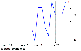
Anglesey Mining (LSE:AYM)
Graphique Historique de l'Action
De Juin 2024 à Juil 2024

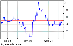
Anglesey Mining (LSE:AYM)
Graphique Historique de l'Action
De Juil 2023 à Juil 2024
